Thursday 28 November 2013

Communication of Disaster Science for Mitigation, Recovery and Reconstruction: what do the users need?


I was recently asked to sit on a panel at the UCL IRIRUK Japan Disaster Risk Reduction Workshop with the question 'Communication of Disaster Science for Mitigation, Recovery and Reconstruction: what do the users need?' I drafted some thoughts as notes, which may be of interest!

1) What is the role of communication in disasters?
My research has focused on Early Warning Systems (EWS), at the interface between science and putting it into practice. I would like to make four keys points / comments on the role of communication in Disaster Risk Reduction (DRR), but specifically looking at the interface between hazard and risk, and focus around the first mile, rather than the traditional ‘last mile’.

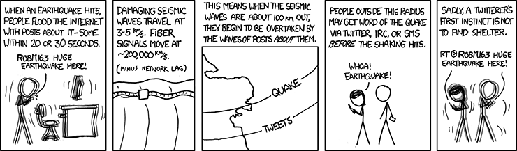
In 2004 the Andaman Sumatra earthquake and tsunami changed the worlds of many people. There was no uncertainty in the case of the tsunami hazard, it had been created, yet more than 230,000 people died, so why that with our scientific capabilities, such devastation and suffering occurred? No warning, or communication tools were present.

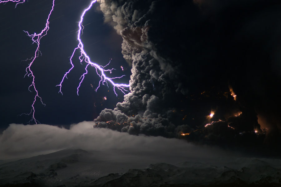
I have focused my research largely around volcanoes, what I believe to be the most challenging of all, producing multiple hazards, when active or inactive, over differing spatiality and temporalities, and often inherently unpredictable, yet they nearly always provide some indication of unrest. The loss of over 23,000 lives by the relatively small eruption of Nevado del Ruiz, in Colombia 1985, is another tragic example where the scientists foresaw the volcanic eruption, the melting of the ice caps, and the generation of a significant lahar that would inundate the City of Armero around 60km away. The key decision-makers and authorities in the city chose not to respond to the warning, with devastating consequences. Barry Voight stated in a key review publication that ‘caused ‘purely and simply, by cumulative human error - by misjudgement, indecision and bureaucratic short-sightedness’ (Voight, 1990, p.383).

2) Investing in communication
It is clear that whilst there is still significant improvement needed in developing our scientific knowledge and capacity to foresee and accurate predict natural hazards, this is of course only part of the requirement in minimising a disaster. Yet, it is the correlation as demonstrated by the Sumatra and Nevado del Ruiz crises, amongst many others, that better science does not equal less disasters that raises questions. 

In the volcano community it is clear to me that most investment goes into developing monitoring capabilities, conducting research, employing staff to interpret data and dedicate years to understanding the unique nature of each volcano. Yet, seemingly little is invested in staff who are able to communicate, integrate, and use the scientific information to reduce and manage risk, with the vulnerable populations, and this person is very overworked. The USGS volcano observatories currently only have one funded outreach officer whereas around ten years ago they had five, and Indonesia now has around 15. With investment in only one side of the equation, the likelihood of disasters could arguably be increasing. 

In fact insurance losses from geological disasters are continuing to rise. The 2011 Tohoku Earthquake and Tsunami in Japan (MunichRe) caused losses of over US$40bn, for example, while the on-going insurance problems and costs in Christchurch, New Zealand stand at over $13bn. While disasters in ‘prepared’ countries are resulting in fewer deaths (despite the large scale of some events), their economic impact is growing as business becomes more dependent on functioning infrastructure in an ever-growing technological and globalised world.

3) How do we communicate across phenomenological knowledge, hazard, and risk?
Many scientists working for government organisations inherently have a legal mandate to monitor and warn about hazardous events, and thus the requirement is to aid the DRR. There are however, some counties more willing than others to invest in integrating ‘social sciences’ to help foster more effective communication and generating meaningful warnings and relationships in preparation for disasters.

Scientists and the user groups are currently really struggling with this relationship and definition and interaction of hazard and risk.  Perhaps two sides of a coin, places such as Indonesia and the Philippines are pioneers that fully embrace that hazard knowledge, assessment is interrelated to risk assessment and knowledge and are treated together, in one organisation. Given the vast numbers and scale of events in both locations, particularly in the context of volcanological hazards, lessons can, and should be sought from these approaches that have recently shown incredible successes, the evacuation of over 1 million people at Mt Pinatubo 1991, the successful evacuations on Merapi in 2010, and the relatively small loss in recent Typhoon Haiyan given the scale of the event.

But another approach, at the other end of the spectrum is also growing in force. Following the 6.3 magnitude earthquake in L’Aquila, Italy in 2009, where 308 people died, approximately 1,500 were injured, and 65,000 people were made homeless, a shock wave has been sent through the hazard scientific community, causing scientists to become increasingly concerned about how much hazard and risk advice they provide prior to a crisis. This has lead to an increase in use of probabilistic representations of uncertainty for forecasts. For more on L'Aquila please see an article I wrote on SciDevNet 'Scientists on trail: lessons for disaster preparedness' or this great piece in Nature 'Scientists on trial: at fault?'.

Scientists now fear being involved in risk management, and only wish to provide information relating to the hazard to the key assigned decision-maker who has to make a decision on how to respond, normally civil protection. This is potentially a dangerous position to be. In any crisis, who is the expert when making key decisions? Whose responsibility is it, and are there traces of accountability in the decision-making process? Roles and responsibilities need to be clearly defined for each country, that fits its legal framework and mandates.

4) What do the users need?
Is there some who can understand the hazard and all the scientific uncertainties involved, as well as the risks posed? Unlikely. Perhaps the models adopted by Indonesia and Philippines amongst others, attempts to bridge this gap. To date, however, there has been relatively little research into how scientists involved in geohazards make sense of scientific data and share hazard information amongst stakeholders, both in the long and short term, and how decisions are made. Without understanding this process, there is perhaps little hope of setting best practices, or at least understanding pros and cons in communication tools and practices

A small insight into this issue, can perhaps be drawn from my own research, in investigating the challenges involved in assigning a volcano alert level, and the issues involved in negotiating uncertainty, risk, and complexity in decision-making processes. This work provides first analysis of the decision-making processes involved in assigning a warning in a volcano alert level system, a tool is used to communicate warning information from scientists to civil authorities managing volcanic hazards, usually but not always based on the activity of the volcano (hazard info only).

Two key findings were discovered. First, that observatory scientists encounter difficulties in interpreting scientific data, and in making decisions about what a volcano is doing, when dealing with complex volcanic processes. Second, the decision to move between alert levels is based upon a complex negotiation of perceived social and environmental risks, not just the hazard. This research establishes that decision-making processes are problematic in the face of intrinsic uncertainties and risks, such that warning systems become complex and nonlinear.

This also shows that hazard and risk are in practice, very difficult to separate, and that by separating them, the gap between expertise on the hazard and risk will get bigger as people become reluctant to be engaged In the other. As such the repercussions of L’Aquila raised interesting questions for us all.

Unless we invest and understand how scientific, hazard, and risk knowledge is created, shared, and effectively communicated, I am not convinced that we will see a reduction in disaster impacts.

So what are the potential solutions?
Hazard scientists work tirelessly to produce information and various products and systems to communicate their work to their user groups. But have we stopped to ask whether this is the information these user groups need and want? Is this information in a format they can understand and use? Unless there is evaluation and analysis on the effectiveness of communication and knowledge sharing, it is possible that scientists are investing limited resources ineffectively?

This in turns requires an investment in researchers and staff to conduct these and develop deeper understanding into bridging science and action.

There also needs to be further consideration to what roles the responsibilities and roles are of various stakeholders, that leads to issues of accountability. Perhaps by clarifying these roles, the issues of hazard and risk assessment and management can be discussed more holistically given the uncertainties involved in geological hazards.

5) To achieve this requires funding and a change in mind set for the hazard community, and a focus also on the first mile, and to invest in it. The question is, what is preventing this?


Tuesday 28 June 2011

Lessons Learnt For Tsunami Early Warning Systems from Japan


This article was published in the Aberystwyth University News Letter Issue 5, 2011. For full illustrated article please click here and see p10 in the PDF.
 
 
The magnitude 9.0 Tohoku earthquake on March 11, 2011 is one of the most documented disasters in history with video footage, photographs, and TV documentaries providing rapid insights into the devastation following the quake. Like millions around the globe, I viewed this footage with horror and a sense of disbelief; the destruction and trauma witnessed are difficult to rationalise. Yet, the early warning system in place saved the lives of at least 50,000 to 100,000 people demonstrating that the devastation could have been far worse; as it currently stands the Japanese National Police Agency has confirmed 14,755 deaths.

The 2004 Sumatra-Andaman tsunami in the Indian Ocean was particularly devastating killing over 230,000 people across fourteen countries, partly because there was no early warning system in place and tsunami awareness was generally very low. Despite this absence a number of people who felt the earthquake in Indonesia and the Andaman Islands moved to high ground, in response to local or traditional knowledge passed down through many generations of those rooted in the area. For these people simple knowledge of tsunamis and understanding their warning signs of an earthquake and a receding ocean proved an effective early warning system by self-evacuating to high ground demonstrating the value of simple education and knowledge.

There appears to be a recurring trend following recent earthquakes greater than magnitude 8.8 that generate tsunamis that inundate coastal communities located near to the epicentre with less than 30 minutes warning. The residents of the Sanriku coast and Sendai in Japan only had 10-30 minutes of warning time before the leading main wave of the tsunami hit, and the earthquake lasted in the region of six minutes, leaving little time to recover and evacuate to higher ground. In 2004, the Indian Ocean tsunami struck Sumatra within 20 minutes of the earthquake killing 168,000 people, when many people were still confused and disorientated by the earthquake. The 8.8 earthquake off the coast of Chile in 2010 generated a tsunami that arrived within 30 minutes in the Valparaiso-Concepcion-Temuco coastline and is responsible for a proportion of the 521 people killed during the event. These instances pose a challenging problem; that even with a sophisticated warning system using the latest technology that can detect an earthquake in seconds and provide a tsunami warning within a couple of minutes, there is often not enough time for potentially affected communities to fully evacuate the tsunami inundation zone. 

Two months on from the devastating Tohoku earthquake it has been demonstrated that in most locations the tsunami early warning system was largely effective; mortality rates in the populations in inundation zones in the worst affected areas of Miyagi and Iwate prefectures was less than 10% compared to over 30% for corresponding areas of Arche in 2004. Areas outside the worst impacted areas e.g. northern Iwate, Aomori and Hokkaido the inundation zones were largely evacuated and casualties were very low, with only a few per town, in contrast to the 10% mortality rates as far away as Thailand and Sri Lanka in 2004, demonstrating the preparedness and effectiveness of the tsunami early warning system. It is clear that we cannot fully rely on early warnings to give enough time for everyone to evacuate (including the young, senior, ill, or disabled), however the Japanese tsunami has proved that the most sensible method of coping with rapid onset tsunamis is to focus on being prepared.

It is becoming increasingly possible to forecast where large scale earthquakes may occur and potentially generate a destructive tsunami. By taking preparedness actions such as good land-use planning can be highly effective, for example high schools in towns along the Sanriku coast built on higher ground had high survival rates. In areas of flat terrain where there was not time to evacuate to safety, especially when a tsunami wave is travelling at high speed, tall strong tower buildings (vertical evacuation sites) need to be built that people can get to in time, albeit a costly solution. Whilst some buildings (e.g. port facilities) and their workforces need to be located by the shore, it may be recommended that populations be located on higher grounds, where possible, including the vulnerable populations of a community. 

The solution therefore is to work on a case by case basis, understanding the local geography, social and cultural contexts, and economic capabilities to prepare for and respond to rapid onset tsunamis for each and every town, city, or region. This requires significant political will, as to standardise preparedness and warning procedures is the easiest and most cost-effective approach. For rapid onset tsunamis there is no time for hesitation, everything needs to be considered because that ten minutes warning needs to be as effective as possible, otherwise, well you have seen some of the footage.

Monday 7 March 2011

Do emergency plans really need scientists?

The recent evaluation of the UK Government's response to a number of crises in 2010 has been published in British media recently. Given my research on volcano early warning systems I have taken particular interest in the review of the Eyjafjallajökull eruption response that generated quite possibly one of the most economically costly volcanic disasters in history. One thing to note upfront, is that the enquiry has not been sufficient at all, and barely scratched at the surface at an issue that is likely to affect the UK and Europe in the future. So already the Government have failed to adequately prepare for the low-probability but high-impact events it has expressed a specific mandate to do by not even taking time to learn from our past mistakes. Interestingly the aviation sector seems to show little interest in investing in further research to understand the impact of ash on jet engines.

An article by BBC News caught my recent attention (http://www.bbc.co.uk/news/science-environment-12623089). It is reasonable that the Commons Science and Technology Committee highlighted 'last April's volcanic ash cloud - which grounded thousands of flights - as an example of poor risk assessment'. Indeed it was poor risk assessment - but not because scientists were unaware that Icelandic volcanic ash could cause trouble for aviation. Professor Sir John Beddington said ash should have been considered given the 'relative frequency of volcanic events in Iceland'. This is interesting given that in only 2004 the volcanic eruption of the Icelandic subglacial Grimsvotn volcano in the Vatnajokull ice cap generated an eruption plume detected on satellite images showing ash drifting into large parts of the North Atlantic, reaching Scandinavia. Air traffic was disrupted with an area of 311,000 square kilometres closed for flights from the beginning of the eruption (November 1) until the morning of November 4. In 2000 a NASA DC-8 airplane suffered significant damage to its engines when inadvertently flying through volcanic ash generated by Hekla volcano in February 2000 (see: http://www.skybrary.aero/bookshelf/books/1161.pdf for full paper and analysis. This paper shows two things: first, volcanic ash from Icelandic volcanoes has been a nuisance to aviation in the past and therefore is not an unidentified risk; second, that volcanic ash can have lasting impact on aircraft that may not be immediately apparent. Clearly this is worrying as many aircraft may have flown through low concentrations of ash ain 2010 and may currently be accumulating wear and tear - like the NASA DC plane - but I digress. Scientists and the aviation sector were well aware of the possibility of volcanic ash affecting European airspace because it has happened before, numerous times. Poor risk assessment took place in understanding the interaction of ash and jet engines, and their sustained impacts.


The result of this enquiry is to generate another independent committee to advise the government on risks. The article states that during the ash ban 'research had to be hurriedly carried out to find out when it might be safe for planes to fly'. I am not sure what research was actually conducted - certainly there was a huge effort to monitor the ash using a variety of new techniques including LIDAR, but in terms of determining safe concentrations of ash, which led to the CAA amending its protocols three times, it seems no new research was done. After 30 years of research into the impact of volcanic ash on engines, I find it hard to see how in 6 days any significant advancement could have been made, other than looking at data from other parts of the world, where the physical and social contexts differ greatly. The Commons Science and Technology Committee examined the use of scientific advice and evidence in national emergencies resulting in MPs stating that the Iceland volcano was a 'stark example' of the lack of scientific input in risk assessment, which seems fair however, they also go on to say that 'the government should take more notice of scientists when deciding how to respond to emergencies'. In some respects I agree; the risk assessment conducted is dependent on scientists who are connected with the Government and able to voice their opinions - of which I was not one, despite the useful research I had conducted that may have helped to have managed the crisis better. However, I fundamentally disagree with this statement. It is precisely because we only have scientists providing a perspective that we are missing out on the expertise of many other stakeholders that could provide valuable insights on how to prepare for such high-impact low-probability events, and react better during a crisis. If the Government wants to make crisis response better then perhaps then need to have a process whereby any specialist or expert (scientist or not) can easily request to be involved and shake this notion that the scientific expert is the only way forward. Almost any resident in Anchorage, Alaska could have told the UK Government about volcanic ash and its impacts, some with startling detail. But to 'flip' this statement around, the Government needs to act on what scientists (and other experts/stakeholders) say, and not just have more or better information to provide ample accountability for identifying and taking reasonable steps to mitigating against an environmental risk. Action is needed: investment is needed, but both go beyond the typical political term. It therefore may be the political system that needs to be reformed if we are to take environmental risks seriously to make sure that a Government can sustain its people, businesses and nation during a crisis. It did not do well with a tiny bit of ash, what happens if another Laki fissure opens in Iceland, like it did in 1783-1784, that would impact agriculture, aviation, trade, and cause significant health hazards for over a year? We are totally unprepared, and tragically the UK Government, like many around the World, are not taking notice of the warning signs that the Eyjafjallajökull eruption really demonstrated rather well.

Thursday 11 November 2010

Science and Technology Committee

Video footage from the Science and Technology Committee on the Eyjafjallajökull Icelandic volcanic ash crisis earlier this year. This video provides an opportunity to understand better the different perspectives of different stakeholders and some of the conflicts that emerge. I will review these in a later post.


Transript is available at: http://www.publications.parliament.uk/pa/cm201011/cmselect/cmsctech/uc498-ii/uc49801.htm

Monday 19 April 2010

Ash cloud obscures success of warning system

Ash cloud obscures success of warning system: article written by me on UCL website:
http://www.ucl.ac.uk/news/news-articles/1004/10041901


Friday 16 April 2010

Info for travellers in the current volcano ash crisis in the UK

It is extraordinary, finally volcano hazards are effecting the UK and it is wonderful to see the global protocols for dealing with volcanic ash work so well in Europe. I have been most excited although for travellers everywhere it must be a miserable experience.

The BBC now have a great page with loads of links regarding the current status of things:
http://news.bbc.co.uk/1/hi/uk/8623806.stm and there was a great clip on the BBC Radio 4 Today Program, that explains what is happening and why. Listen again on http://news.bbc.co.uk/today/hi/today/newsid_8624000/8624534.stm including an interview with Prof Steve Sparks.

The flight restriction has now been extended to 1am Saturday 17th, see http://www.nats.co.uk/ for further updates..You can also see updates on the London Volcanic Ash Advisory Centre website: http://metoffice.com/aviation/vaac/vaacuk_vag.html. If the graphics still indicate there is likely to be ash over the UK, then I think the ban is going to continue to be extended.

The problem at the moment is that the volcano is still erupting, and that the wind movements over the UK and Europe are very slow, and blowing ash across the UK. Regarding the volcano, it is still erupting. Most volcanologists in Iceland feel that the volcano will not erupt at such explosive levels for more than a few days, but it could continue for weeks or months. However, the intensity is likely to drop within a few days. There is no website with monitoring data like the wonderful USGS websites, so at the moment the likely behavior the volcano is based on past behavior. According to Prof Bill McGuire on http://www.abuhrc.org/newsmedia/Pages/news_view.aspx?news=37 the last eruption of Eyjafjöll lasted more than 12 months so this is probably the worst case scenario. Another bleak scenario is that Katla volcano to the west of the Eyjafjöll has historically been triggered by activity at its neighbour, so there may be more potential activity in the future. See http://www2.norvol.hi.is/page/ies_Eyjafjallajokull_eruption for more information and updates on the volcanoes behavior.

Coming back to practicalities though, it is very hard to say if the flight restrictions will be removed by tomorrow. I think that things are not looking too optimistic right now. So my advice would be to get yourself booked in for a few more days and try and make the most of your extended break and get yourself booked up on a flight as soon as possible. It will be pandemonium here as so many flights have been missed and people will be trying to get seats on already fully booked flights.The trains and ferries are also overbooked, so be cautious if flying into mainland Europe to get across to the UK.

Hope this information gives you the tools to do some monitoring yourself. If you are frustrated about the situation, read http://news.bbc.co.uk/1/hi/magazine/8622099.stm and hopefully you will realise it is better to be safe than sorry when it comes to volcanic ash.

Thursday 15 April 2010

Earthquake warning systems (and twitterers)

(Source & image credits: xkcd (cartoon 723))

Fun cartoon but it may well be the future for many early warning systems.